

Navtex wars are taking place in the Eastern Mediterranean. After Turkey announced the territory that it would do the drilling, Athens stated that they would not allow it by beginning a counter-Navtex. In response, Turkey announced they would “enter the field with missiles!”
Everything started with Turkey’s entry into NATO.
After attaining NATO membership in 1952, the Turkish Navy was imprisoned in the Black Sea, with the excuse that “there is a Soviet threat”. While we were establishing a submarine base in Ereğli, Greece assumed the Aegean and Mediterranean gendarmerie of NATO. During NATO exercises, the Greek Navy was assigned duties in the fields of Turkish sovereignty, and the occupation was knitted step by step. Until we saw the truth in Cyprus…
Turkey’s position in the Mediterranean is a history fraught with painful experiences. Following the Cyprus Peace Operation in 1974, sea bases were rapidly established in Aksaz and Foça, and the Mersin base was expanded. İskenderun was transformed into a modern facility. An important power of the Turkish Navy was sent to the west and south coasts. The fight would have been fiercer in the Mediterranean since the early 2000s.
In 2002, the Greek Cypriot Administration of Southern Cyprus (GCASC) flagged Northern Access vessel announced that it would conduct geophysical surveys on a site starting just east of the Crete, Karpathos and Kaşot line. This region of Turkey is within the border of the continental shelf that is counted as ab initio (from the beginning) and ipso facto (by itself), and does not require any announcement. The staff of our Navy saw the game and have developed a new defense concept in the Mediterranean since 2006. In this context, Operation Mediterranean Shield would be carried out regularly in the Turkish continental area, and Turkish rights and interests would be defended by showing weapons if necessary. The father of the idea was Admiral Cem Gürdeniz.
Thereupon, the European Union had the University of Seville prepare the European Maritime Jurisdiction Map. According to this map, Crete, Karpathos, Kaşot, Rhodes and Meis line have been accepted as the relevant coast, and Greece and GCASC have become neighbors. According to the map, Turkey was imprisoned in Antalya Gulf, and 189,000 square kilometers maritime jurisdiction areas were reduced to 41,000 square kilometers. This map has been processed in all international institutions and organizations for years in NATO and EU exercises. If you want to do research even in the UN records today, these maps still appear.
The reason for making this brief summary is to better analyze the drilling tensions between Greece and Turkey in recent days is that Turkey discarded the Seville map by signing the Memorandum of Restriction of the Maritime Jurisdiction with Libya on November 27, 2019. In doing so, the memorandum relied on the following 4 basic principles of the 1982 United Nations Convention on the Law of the Sea:
(1) Equity (It means that states with opposite coasts share the seas fairly.)
(2) Superiority of Geography (Based on the mainland in the delimitation means that the islands that are on the opposite side of the bisector line have sea authority as much as their territorial waters.)
(3) Proportionality (In the delimitation, it means that the maritime jurisdiction states will have is proportional to the coastal lengths.)
(4) Not closing (means that the islands close to the coasts of another state should not prevent this coast from sailing.)
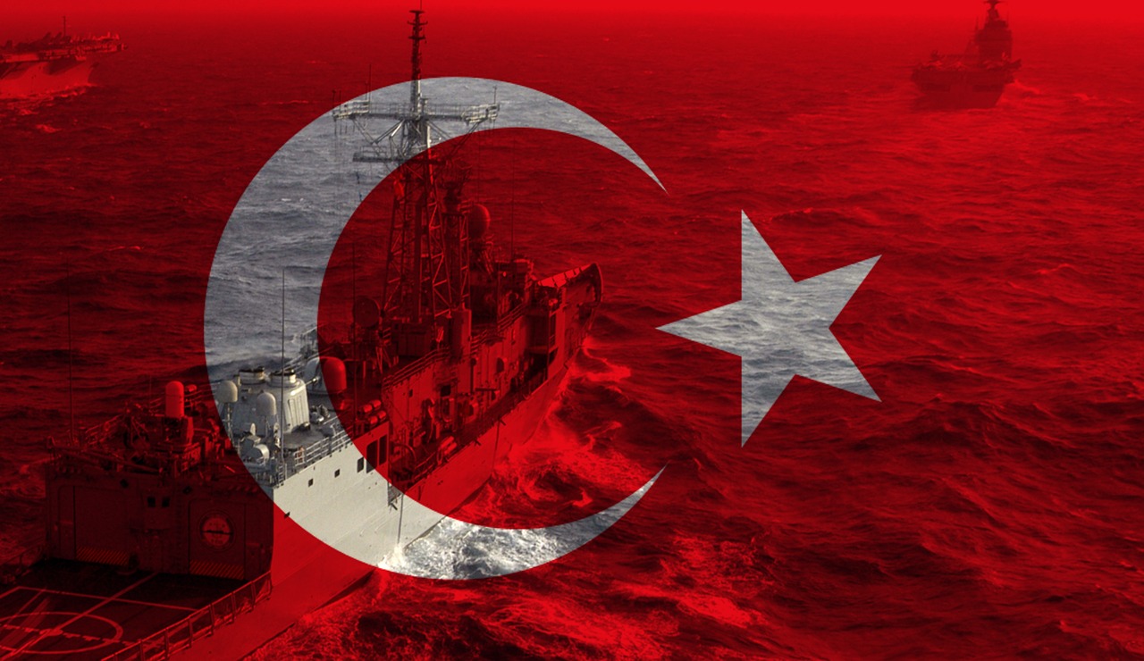
The Turkish Navy, which draws its jurisdiction within the framework of these basic principles, maintains its rights and interests in the 189 thousand square kilometers Blue Homeland in the Eastern Mediterranean.
DRILLING TENSION
Between June 21 through August 2, Turkey announced that it would conduct seismic exploration via a Navtex announcement. The Turkish Navy, who knew well that this announcement was to block the map of Seville, took precautions days before. The permits were canceled and preparations were made on ships in Aksaz. An effective message would be given to the world. Over 10 corvettes, frigates, Coast Guard ships and fuel tankers were prepared. Coordination with the Air Force was provided. The smallest spark could have caused a big fire; SAT and SASs are located in Antalya. Greece had already prepared a four-stage response plan against such a situation a month ago and announced that it would use weapons if necessary. They were going to be crowded out – they needed a deterrent.
On July 21, Turkish ships landed on the field. Seeing the preparations of Turkey, Greece was forced to respond to the Navtex with a counter-Navtex. They begged the US and the EU for help. This was because the Greek Navy was old: they had no strength to respond. While Turkey was launching a new ship into the sea every year, Athens had been trying to get frigates from France since 2009. The Germans bribed Greek officials and sold problematic submarines. Athens boasted of making small boats and was organizing launching ceremonies. The balance had been disturbed, and it turned in favor of Turkey. As if that were not enough, Ankara raised the hand and announced that they would conduct missile experiments under the drilling site. Even the gods can no longer save Athens.
THE REALITY OF MEIS
While I am narrating these events as though it were all a story, this is actually a new Cyprus landing. The Turkish Navy does its part, but we need to learn our theses well. First of all, the Meis problem should not be evaluated as single. The official thesis of Greece is based on the claim that the Meis, Karada, and Fener islands form an archipelago. The legal status of the archipelago differs from the exclusive islands in terms of influence. But we have an important decision: the South China Sea Arbitration Case. In this case, the Arbitral Tribunal interpreted Article 121/3 of the UNCLOS and determined the criteria between the rock and the fully competent island. The decision emphasized the following; “Rocks which cannot sustain human habitation or economic life of their own shall have no exclusive economic zone or continental shelf.”
Meis is called harvest-less Island throughout history. If you plant grass, it does not grow, and it cannot produce its own economy. It has no traditional people. It is entirely dependent on external supplies. When Turkey stops tourism to this island, it stops completely. As a matter of fact, 350 people left the island due to the sonic booms of Turkish F-16s last week. Karaada and Fener Island are not even subject to the debate: 9 people live on one and 15 people on the other. Greece placed them there with its resettlement policy. They were likely agents.
ISLANDS ON OPPOSITE COASTS
On the other hand, the whole world knows that the islands that are on opposite sides cannot influence the restriction of maritime jurisdiction between the two countries. The International Court of Justice (ICJ) in Hague has 17 similar cases. All confirms the thesis of Turkey. The decisions about Filfla, Serpents, Qitat Jarada, Alcatraz, Djerba, and Saint Pierre & Miquelon islands are obvious. Interestingly, the US claims in the South China Sea refute Greek theses. The Greece-Italy agreement is to literally put a bullet into its own feet. Now, Athens is thinking about how to get out of this business.
Nevertheless, everything is not OK. Athens’ new plan is to go to the International Court of Justice for Meis with Egypt; they are planning a fait accompli. In the decision to be taken here, it is calculated that the islands can be affected, albeit in a limited way. They carried out the settlement policy with this account for years; but there is a problem. Greece had repeatedly declared that it did not recognize the Court’s decisions. Even the Greek state bureaucracy eliminated the option to go to the ICJ in 2015 due to the decisions it made. Athens excluded some dispute issues from the dispute resolution process within the framework of the UN Maritime Convention, stating that it will not be subject to the resolution process of disputes involving the UN Security Council.
While, in its 1994 declaration, Athens excluded only “defensive military activities” from the Court’s jurisdiction within the scope of the security of the non-military status of the Eastern Aegean islands, with its new notifications dated 14 and 16 of January 2015, it expanded its reservations, which have been become jurisdiction by the ICJ, including the territorial waters, aerial domain and sovereignty issues. In other words, in domestic law, the ICJ path was closed. They have to deal with this first.
THE GREATNESS OF TURKEY
While all this tension is experienced in the Eastern Mediterranean, the question of whether we have a deficit on other fronts comes to mind. Our naval power is exactly the same in Libya. It is whatever it is at first: we have not withdrawn a ship yet. In short, the Navy is writing a new saga. Tearing up maps is part of the Turks social-genetic code. After tearing Sevres apart and thwarting the Great Middle East Project, Turkey is now drowning the map of Seville in the waters of the Mediterranean.